Mount Pilatus Hikes: The Peaks and the Paths Down
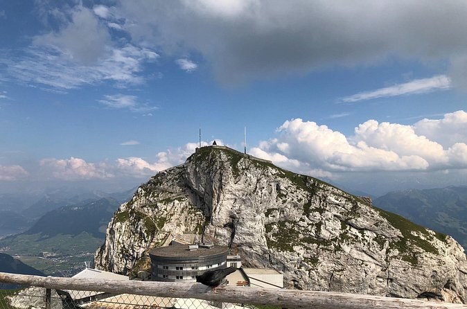
The short answer. From the summit station, you reach the Oberhaupt in about 10 minutes and the Esel in about 30. The flower trail to the Tomlishorn, the highest point, takes about an hour and a half there and back. The full climb from Kriens or Alpnachstad takes about 5 hours. Summit hikes are recommended from mid-June to October; lower trails between the stations are open all year.
You do not have to be a hiker to walk on Pilatus. Most people who ride up spend some of their time on foot, on short, well-made paths from the station to the peaks around it. The longer trails link the stations on the Kriens side and climb from the valleys, and they turn a half-day into a full one. A Mount Pilatus guided tours leaves you an hour or two at the top, enough for one of the short routes. The longer ones need a ticket of your own and a free morning.
| Walk | From | Time | Grade | Season |
|---|---|---|---|---|
| Oberhaupt viewpoint | Pilatus Kulm | About 10 min | Easy | Summer and winter |
| The path through the rock | End of the Panorama Gallery | About 20 min | Easy | Parts closed in winter |
| Esel viewpoint | Pilatus Kulm | About 30 min | Easy | Summer |
| Flower trail to the highest peak | Pilatus Kulm | About 1 h 30 | Easy | June to October |
| Dragon Moor circuit | A circular trail | About 1 h 30 | Easy | All year |
| Krienseregg to Fräkmüntegg | Krienseregg | No time listed | Easy | All year |
| Fräkmüntegg up to the summit | Fräkmüntegg | Short and steep | Challenging | June to October |
| Alpnachstad up to the summit | Alpnachstad | About 5 h | Challenging | June to October |
The peaks around the station
Pilatus is a ridge of peaks, and the station sits among them. The Oberhaupt, the rock on the west side with the weather and radar installations, is the quickest: about ten minutes for a view along the ridge. The Esel, just east above the station, takes about half an hour, and Pilatus-Bahnen rates it probably the best viewpoint on the mountain.
The highest point is neither. The Tomlishorn, at about 2,128 metres, lies some 1.3 km southeast of the station. The flower trail that leads there is the one longer walk most visitors can manage. You need about an hour and a half there and back, from June to October, and you pass protected alpine flowers on the way. The guided barbecue hike walks to the same peak before lunch.
Between the stations on the Kriens side
You can step off the panorama gondolas at Krienseregg and at Fräkmüntegg and get back on later, which makes the Kriens side the easy place to walk. Pilatus-Bahnen's own list of top routes includes Krienseregg to Fräkmüntegg by Schönenboden, a gentle walk through woodland that works all year and suits a hot day. The Dragon Moor circuit is a family trail of about an hour and a half through a protected high moor. Boards along it explain its history, plants and animals.
The family trails around Krienseregg and Fräkmüntegg are graded T1 and T2, easy to medium on the Swiss hiking scale. No hiking trail on the mountain suits a pushchair, though. At Fräkmüntegg, the Fräkigaudi toboggan run, Switzerland's longest summer run at 1,350 metres, is a few minutes from the station, open from April to October in good weather.
The two climbs to the summit
Two of the listed routes are for experienced walkers. From Fräkmüntegg, a short but steep path climbs by the Heitertannliweg and the Klimsen saddle to the summit. From Alpnachstad, the classic route follows the cogwheel railway all the way up past Ämsigen, with the lake below you. Pilatus-Bahnen puts the whole climb at about 5 hours from Kriens or from Alpnachstad, and rates both summit routes challenging.
Ride down afterwards. A one-way fare from either valley to the summit costs CHF 42 for an adult in 2026, and fares and passes lists the rest.
Getting to the start
For the Kriens trails, take bus 1 from the stop in front of Lucerne station to Kriens, Zentrum Pilatus, about 11 minutes, then walk up to the gondola station. For the classic climb from Alpnachstad, the train from Lucerne takes under 20 minutes. If you plan to walk up and ride down, buy the one-way ticket at the summit. How to get there has the timetables.
What to bring
- Easy walks: good shoes with grip, a weatherproof layer and plenty of water.
- The summit climbs: proper hiking boots, poles, a map or a hiking app.
- A barbecue: there are public fireplaces around the mountain, with firewood at Krienseregg and Fräkmüntegg, but none on the summit.
- Tickets: no need to buy ahead; every station sells them. A cogwheel seat reservation is the one thing worth booking early.
Guided hikes and early starts
The hiking clubs of Lucerne, Nidwalden and Obwalden run guided walks in the Pilatus area that are usually free and open to anyone. Pilatus-Bahnen runs sunrise hikes, and on selected dates an alpine bus takes walkers from Alpnach Dorf to Alp Lütholdsmatt four times a day, with limited seats. Restaurant Fräkmüntegg serves a hiker's breakfast for an early start or a late finish.
Want a guide and lunch handled? The Swiss barbecue hike walks to the highest peak with a local guide and ends with a barbecue, meat or vegetarian. It costs $154 a person, tickets included. The ibex you may meet on the way died out here in the 17th century and were brought back from 1961. In 2012 there were 109. If you would rather spend the night and walk at first light, read a night on Mount Pilatus.
Where these facts come from
- Pilatus-Bahnen: hiking
- Pilatus-Bahnen: viewpoints
- Pilatus-Bahnen: the Dragon Path
- Pilatus-Bahnen: the toboggan run at Fräkmüntegg
- Pilatus-Bahnen: travel preparation FAQ (reservations, boats and the round trips)
- Pilatus-Bahnen: ticket prices 2026, travelcards, groups and dogs
- MeteoSwiss open data: monthly values, station Pilatus (PIL), 2,105 m
- Wikipedia: Pilatus (mountain)
- Wikipedia (German): Pilatus (Bergmassiv), history, legends and wildlife
Tours with time to walk
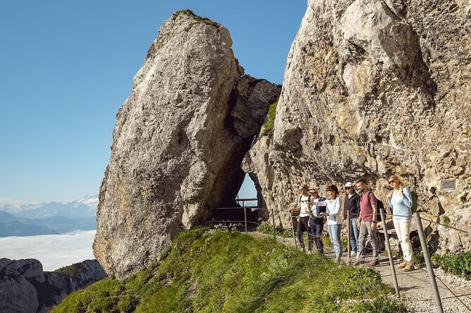
Swiss BBQ & Hike Experience – with Mount Pilatus Ticket
An easy guided hike from the summit to the mountain's highest point, then a Swiss barbecue lunch, meat or vegetarian. The bus and cable car tickets are in the fare.
From $154 per person
Check Availability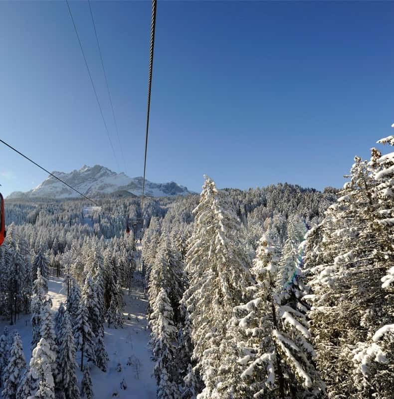
Kriens: Mt. Pilatus by Panoramic Gondola and Aerial Cableway
The cheapest way up: the panorama gondola and the cableway from Kriens to the summit and back, on the side that runs all year outside its overhaul.
From $72 per person
Check Availability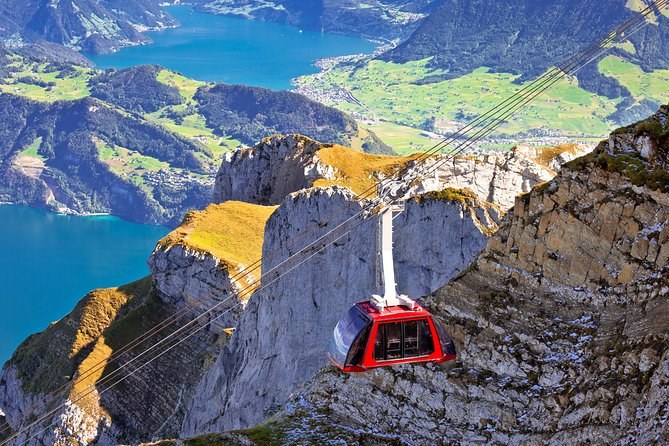
Mount Pilatus (Private Tour)
A driver-guide collects you at your Zurich hotel in a Mercedes for the whole loop, about four hours on the mountain and time in Lucerne. For up to 12.
From $678 per person
Check AvailabilityNext: plan a stay above the day crowds with a night on Mount Pilatus. Every guided day, private day and railway ticket up the mountain sits side by side on Mount Pilatus Tours.